Updated Map of Bush Fire Prone Areas (May 2017)
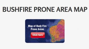
The latest Map of Bush Fire Prone Areas released 31st May 2017, updating the areas of Western Australia where bushfire risk may need to be assessed as part of planning and building applications.
For people developing or building properties, inclusion in the bushfire prone areas of the map may mean their property needs to meet higher standards, to limit the impact of bushfires and the potential loss of lives.
Office of Bushfire Risk Management (OBRM) A/Director Tim McNaught said those in affected areas were required, as a minimum, to have a Bushfire Attack Level (BAL) assessment prior to development, the outcome of which would determine the measures they need to put in place.
“This will lead to the building of homes in bushfire prone areas that are better able to withstand bushfires, as well as encouraging better informed land use,” he said.
“The map was introduced to address key recommendations from the Keelty Report, which investigated the loss of 71 homes in Perth’s bushfire prone suburbs of Roleystone and Kelmscott in February 2011.”
The map is reviewed annually in partnership with local governments to identify any required updates, including:
• where vegetation has been cleared, such as for new subdivisions or roadways;
• where vegetation has re-grown, such as through site rehabilitation or landscaping works, or in commercial plantations; and
• where vegetation management practices are in place or have changed.
Source: https://www.dfes.wa.gov.au/mediareleases/Pages/MediaRelease.aspx?ItemId=803
- May 2025
- April 2025
- February 2025
- November 2024
- October 2024
- September 2024
- August 2024
- May 2024
- April 2024
- August 2023
- July 2023
- April 2023
- May 2022
- February 2022
- November 2021
- March 2021
- February 2021
- January 2021
- November 2020
- October 2020
- August 2020
- June 2020
- April 2020
- March 2020
- February 2020
- November 2019
- August 2019
- March 2019
- January 2019
- November 2018
- October 2018
- May 2018
- March 2018
- February 2018
- November 2017
- October 2017
- September 2017
- August 2017
- June 2017
- April 2017
- March 2017
- February 2017
- January 2017
- December 2016
- November 2016
- August 2016
- July 2016
- May 2016
- April 2016
- March 2016
- February 2016
- January 2016
- December 2015
CATEGORIES
ARCHIVES
- May 2025
- April 2025
- February 2025
- November 2024
- October 2024
- September 2024
- August 2024
- May 2024
- April 2024
- August 2023
- July 2023
- April 2023
- May 2022
- February 2022
- November 2021
- March 2021
- February 2021
- January 2021
- November 2020
- October 2020
- August 2020
- June 2020
- April 2020
- March 2020
- February 2020
- November 2019
- August 2019
- March 2019
- January 2019
- November 2018
- October 2018
- May 2018
- March 2018
- February 2018
- November 2017
- October 2017
- September 2017
- August 2017
- June 2017
- April 2017
- March 2017
- February 2017
- January 2017
- December 2016
- November 2016
- August 2016
- July 2016
- May 2016
- April 2016
- March 2016
- February 2016
- January 2016
- December 2015


